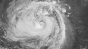
TYPHOON Nesat (Neneng) forced almost a thousand people in northern Philippines to flee, the local disaster agency said on Sunday, as President Ferdinand R. Marcos, Jr. vowed to help typhoon victims.
In a report, the National Disaster Risk Reduction and Management Council said 960 people mostly from the Cagayan Valley region had been evacuated, with more than 350 people staying inside temporary shelters.
It said 5,357 people from 1,472 families were affected by the typhoon.
What was first labeled a storm reached typhoon category after it continued to intensify, the local state weather bureau said in a 2 p.m. bulletin.
“Further intensification is likely as this tropical cyclone moves over the West Philippine Sea,” it said, referring to areas of the South China Sea within the Philippines’ exclusive economic zone.
The storm was last spotted 145 kilometers west of Calayan, Cagayan, with sustained winds reaching as fast as 120 kilometers per hour (kph) near the center and gusts of as much as 150 kph, it added.
The government was closely watching the storm and was ready to help affected people, Mr. Marcos tweeted.
The Philippines lies along the typhoon belt in the Pacific and experiences about 20 storms each year. It also lies in the so-called Pacific Ring of Fire, a belt of volcanoes around the Pacific Ocean where most of the world’s earthquakes strike.
The southeast Asian nation constantly experiences unavoidable losses and damage equivalent to 0.5% of its annual economic output mainly due to an increasingly unpredictable climate, according to the Finance department.
Mr. Marcos said state resources would be used to “ensure the primary needs of those affected, especially food, safe drinking water and electricity.”
“Nevertheless, to the provinces in the north that have felt the effects, help is on the way. We encourage everyone to follow the directives of your local government units and Municipal Disaster Risk Reduction and Management Councils,” he said in another tweet.
The storm continued to intensify as it moved away from the Babuyan Islands, where winds had “storm-force strength,” the state weather bureau earlier said in an 11 a.m. bulletin. Gale-force winds were also expected in areas under Signal No. 2.
The island group including Batanes would continue to experience moderate to heavy and at times intense rains, along with Apayao, Ilocos Norte and Ilocos Sur, it added.
Expect light to moderate and at times heavy rains over Batanes, the northern portion of Cagayan and the rest of the Cordillera Administrative Region and Ilocos Region, the agency said.
Several areas were earlier placed under tropical cyclone wind signals — the southern portion of Batanes that includes Basco, Mahatao, Uyugan, Ivana and Sabtang, as well as the Babuyan Islands.
The rest of Batanes and Cagayan, Apayao, the northern portion of Abra including Tineg, Lacub and Lagayan, as well as Ilocos Norte were under Signal No. 2.
Placed under Signal No. 1 were the northern and central portions of Isabela including the towns of Santa Maria, San Pablo, Maconacon, Divilacan, Palanan, Ilagan City, Tumauini, Cabagan, Santo Tomas, Quezon, Delfin Albano, Mallig, Quirino, Gamu, Roxas, San Mariano, Benito Soliven, Naguilian, Burgos, Reina Mercedes, San Manuel, Aurora, Luna, Cabatuan, San Mateo, Dinapigue and Cauayan City.
Kalinga, the rest of Abra, Mountain Province and the northern part of Ifugao including the towns of Aguinaldo, Alfonso Lista, Mayoyao, Hungduan and Banaue were also under Signal No. 1.
The northern and central portions of Ilocos Sur including the towns of Sinait, Cabugao, San Juan, Magsingal, Santo Domingo, San Ildefonso, San Vicente, Santa Catalina, Bantay, City of Vigan, Santa, Caoayan, Narvacan, Nagbukel, Santa Maria, San Esteban, Santiago, Burgos, Banayoyo, Lidlidda, San Emilio, Quirino, Gregorio del Pilar, Galimuyod, Candon City, Santa Lucia, Salcedo, Cervantes, Suyo, Sigay and Santa Cruz were likewise under Signal No. 1.
It was expected to leave the Philippine area of responsibility on Sunday afternoon or evening. It could further intensify and become a typhoon as it moves over the South China Sea, it added. — Norman P. Aquino

